

 by Carla1
The aquarium of the world.
Free and Sovereign State of Baja California Sur
The state is named after the peninsula on which it is found, Baja (Lower) California, with the term “Sur” meaning “south”. The name California applied to this peninsula along with the area now known as the state of California in the United States. The coat of arms emphasizes the state’s connection to the sea, including images of silver fish, a silver shell and a blue background.
The state is on a narrow peninsula which broke away from the mainland about two million years ago due to tectonic activity. The territory is primarily mountains or mountain ranges and coastal plains. The mountain ranges parallel the coastline and are of volcanic rock. The local name for the main mountain range is the Sierra de la Giganta and the highest peak is the Sierra de la Laguna at 2080m above sea level. The coastal plains are significantly wider on the Pacific side, averaging about 40 km, with much wider plains such as those of Santa Clara, Berrendo and Magdalena y Hiray. These areas are dominated by sedimentary rock, especially limestone of marine origin.
The state is divided into five regions: Central Desert, La Serranía, the Vizcaíno Desert, the Magdalena Plains and Los Cabos. The Central Desert has desert plants, with vegetation springing up during short and irregular rains. The La Serranía is the high mountain areas with significant tree cover, some species of which are commercially valuable. The Vizcaíno Desert runs along the Pacific coast around the Ojo de Liebre and San Ignacio lagoons; it contains lower mountain ranges such as the San Francisco, San Alberto, Las Tinajas de Murillo and El Serrucho, along with the El Azufre and Las Vírgenes volcanos. The Magdalena Plains is a large, flat area near the Pacific coast, and the Los Cabos region is distinguished by microclimates determined by the geologic change in the area and rain patterns.
The climate of the state is dry, with an average annual temperature of 18–22 °C and average annual rainfall of less than 200mm. The lower elevations are the driest and hottest, with summer daytime temperatures above 40 °C; wintertime temperatures may fall below freezing. The exception to desert conditions is the Los Cabos region, classified as semi-moist because of Pacific hurricane activity which affects the region. In the spring, prevailing winds are from the west and in the summer from the south and southwest. In the fall, they are from the northwest and in the winter from the north and northwest.
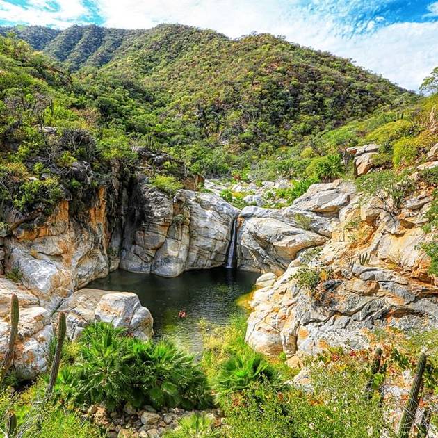
Most of the surface water is in the form of seasonal streams, which are fast-flowing and only active during stormy weather. Most of these drain into the Pacific Ocean, with a number flowing south into the Bahía de Ballenas.
The main geological feature of the state is its coastline which measures 2230 km, making it Mexico’s longest with 22% of the total. It also has the most islands, mostly in the Gulf of California. There are three in the Pacific, Natividad, Magdalena and Santa Margarita (the largest). In the Gulf of California, they include San Marcos, Coronados, Carmen, Montserrat, Santa Catalina, Santa Cruz, San Diego, San Jose, San Francisco, Partida, Espiritu Santo and Cerralvo. Major bays include Sebastian Vizcaino, Magdalena, La Paz, Asunción, Ballenas, Concepcion and San Carlos. Estuaries and lagoons including those at Puerto Escondido, Nopoló, Blandra as well as the San José estuary at Cabo Colorado, the San Ignacio Lagoon and the Ojo de Liebre.
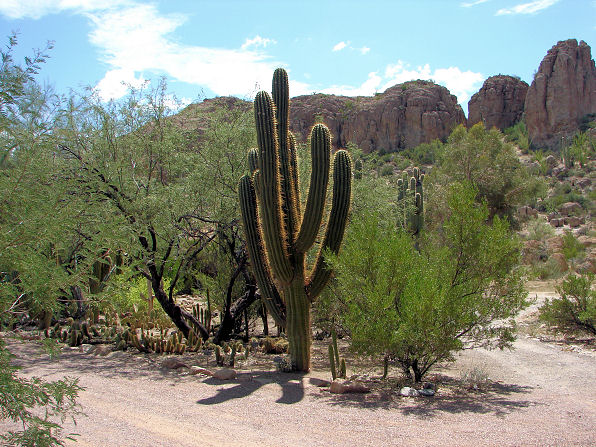
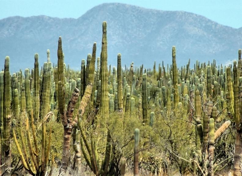
The ecological system here is considered to be recently evolved with a number of endemic species. The lower elevations are dominated by desert and arid condition plants. This includes the world’s largest species of cactus, the cardón cactus, which can reach heights of 15m. Other plant species include mesquite, chironola, lechuguilla, nopal and barrel cactus, choyas, paloadan and pitahaya. The higher elevations have forests of pine and holm oak with some deciduous forests, with leaves falling in the dry season, generally no taller than fifteen meters. Wildlife in the desert areas is restricted to birds, reptiles and small to medium mammals such as rabbits and coyotes. Upper elevations with more vegetation can have wild sheep, pumas and other wild cats, raccoons, deer, and foxes. Marine species include whales, seals, dolphins, gray whales, manta rays and sea turtles.

Baja California Sur has the largest protected surface area in Mexico, 38.3 % of the state in 10 official protected areas: Bahía de Loreto National Park (510,472.2 acres), Cabo Pulmo National Park (17’570 acres), Espíritu Santo Archipelago National Park (120,228.70 acres), El Vizcaíno Biosphere Reserve (6,293,255.76 acres), Ojo de Liebre Lagoon Bioshere Reserve (196,026.15 acres), Sierra de la Laguna Biosphere Reserve (277,838.05 acres), Balandra Protection Area of Flora and Fauna (6,209.09 acres) and Cabo San Lucas Protection Area of Flora and Fauna (9,874.42 acres). Also, the islands located in Baja California Sur coastline on the Pacific Ocean and the Gulf of California are protected under Pacific Islands of the Baja California Peninsula Biosphere Reserve with Baja California, and Islands of the Gulf of California Protection Area of Flora and Fauna, which shares with the states of Baja California, Sinaloa and Sonora.
Questions? Let me know your comments, follow my social networks and find me in the following hashtags: #relocatetobaja #cidchacon #shoppingwithcid